F
Francesca Lombardi
Milan, Italy
May 31, 2025

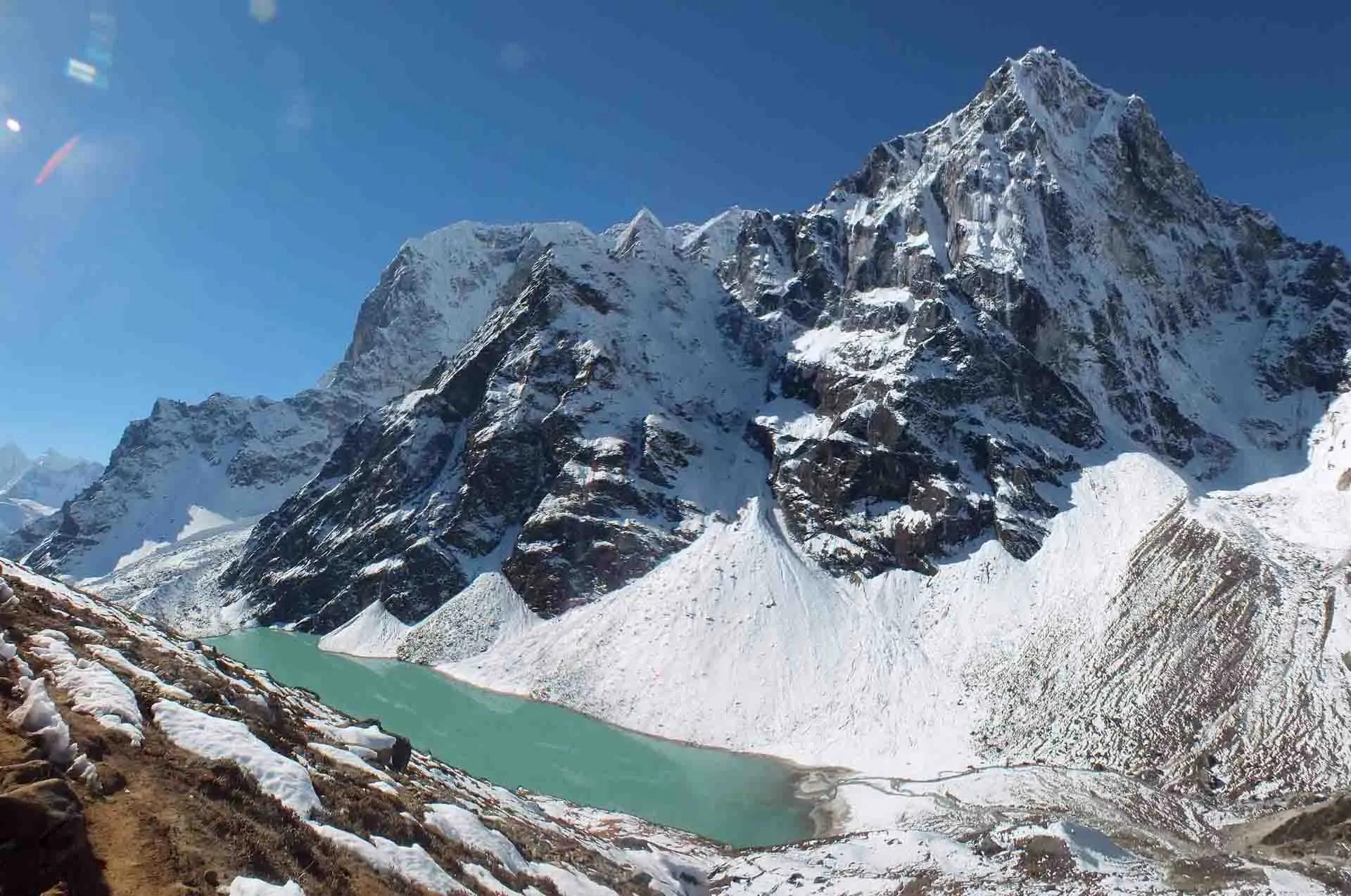
Standing at 5,360m looking over the entire Gokyo Lake system and the peaks beyond was the perfect way to close out three weeks of demanding trekking.
Destination
Nepal
Duration
19 Days
Best Weather
March, April, may, September, October & November
Max Altitude
5545 (Kala Patthar)
Accommodation
Hotel and Tea house
Meals
Full Board during Trek and Breakfasts, Welcome and Farewell meals in Kathmandu
Transportation
Private vehicle / Flights
Group
Min. 1 Pax
Difficulty
Strenuous
Activities
Trekking
The Everest Three Passes Trek is a 19-day loop through the Khumbu region of Nepal, run by Alpine Club of Himalaya. It is a hard trek for people who have walked at altitude before.
You cross Kongma La (5,535 m), Cho La (5,420 m) and Renjo La (5,360 m). From the passes you see Everest, Lhotse, Makalu and Cho Oyu. The route joins the Everest Base Camp trail, the Gokyo Valley and the quieter Nangpa La Valley, so one trip covers ground most trekkers split across two or three treks. Along the loop you reach Everest Base Camp, climb Kala Patthar for sunrise, walk beside the Gokyo Lakes and go up Gokyo Ri for a view all the way around. You also climb Chhukung Ri early on, which takes you above 5,500 m before the first pass. You pass through Sherpa villages such as Namche Bazaar, Marlung and Thame, and walk by monasteries, mani walls and prayer flags.
If you want something easier that still includes Gokyo Ri, Kala Patthar and Everest Base Camp, take the Everest Base Camp Trek via Gokyo Lakes (18 days). It skips the passes. The Three Passes route is for people who have trekked at altitude and want the full loop.
Each pass has its own view. Kongma La looks across the Khumbu Glacier to Nuptse, Everest and Makalu. Cho La looks over glaciers and the face of Cholatse and Ama Dablam. Renjo La looks back over the whole Gokyo Lake system with Everest, Lhotse, Makalu and Cho Oyu behind it.
Memorable moments include:
Kongma La (5,535 m). The highest and usually the hardest of the three, crossed on Day 9 from Chhukung to Lobuche. It is a long day of 8 to 10 hours with a steep rocky climb, a cairn and prayer-flag summit, and a rough descent over moraine and the Khumbu Glacier. It comes early in the trek, after two acclimatization days and the Chhukung Ri hike. If a trekker is not ready, the guide can take the direct trail from Chhukung to Lobuche instead.
Cho La (5,420 m). Crossed on Day 12 from Dzongla to Thangnak. The climb is steep, with boulders to scramble over, and the final section curves around a crevasse. Snow and ice are common, and microspikes are often needed. The descent is long but easier, and it ends beside the Ngozumpa Glacier.
Renjo La (5,360 m). Crossed on Day 15 from Gokyo to Marlung. It is usually the easiest of the three, with a stone staircase section and a long view over the Gokyo Lakes and Everest. Ice on the descent can make the trail slippery, so take it slowly.
The trek covers about 139 km on foot, an average of roughly 11 km a day. Days at lower altitude are longer in distance (12 to 19 km), while pass days are shorter in distance but much longer in hours because of steep, rough ground and thin air. On Kongma La, Cho La and Renjo La, expect 7 to 10 hours for 6 to 11 km.
You sleep above 4,700 m for ten nights (Chhukung, Lobuche, Gorak Shep, Dzongla, Thangnak, Gokyo and Marlung at 4,210 m close to that), so time at altitude is long even though you only spend a few hours above 5,300 m on each pass.
Spring (March to May). One of the most popular seasons in Nepal. Weather is relatively stable, skies are clear and the rhododendron forests are in bloom at lower altitude. Days are warmer, but snow can still lie on the passes in March and early April.
Autumn (September to November). Usually considered the best time for the Three Passes because of dry weather, clear views and cooler temperatures. October is the busiest month. Late November is colder, with more snow possible on Cho La.
Avoid the monsoon (June to August) because of heavy rain, poor views and landslide risk. In winter (December to February) the passes can be snow-covered, very cold and sometimes impassable. If you plan to trek in winter, ask us about the conditions first.
Typical temperatures: in October and April, days are mild in Lukla and Namche, nights around freezing in Dingboche and well below freezing (down to about -10 °C or colder) at Gorak Shep and Gokyo.
The Everest Three Passes Trek is a strenuous, high-altitude trek best suited to experienced trekkers. Plan on 6 to 8 hours of walking per day, and longer on the three pass days. You spend several days above 5,000 m, which raises the risk of altitude illness if acclimatization is rushed. The terrain is rough, with rocky trails, steep ascents and descents, glacier crossings, and sections that may be snow or ice covered depending on the season. Mountain weather can change quickly.
Technical climbing skills are not needed, but this is a physically and mentally demanding trek. For well-prepared trekkers with a good guide, the reward is one of the best routes in the Himalayas.
It is hard for first-time trekkers. The altitude, the length of the trip and the long pass days leave little room for error. If you have never trekked above 4,000 m, we suggest doing the Everest Base Camp trek or the Everest Base Camp via Gokyo trek first. Very fit first-timers can attempt the Three Passes, but talk to us before booking.
To complete the trek you need excellent physical condition, with strong cardiovascular endurance and leg and core strength. You will walk for long hours at altitude with a daypack, often on steep, uneven ground. Prior multi-day trekking experience, particularly above 4,000 m, is strongly recommended.
Training should include regular hiking (ideally at altitude), aerobic work such as running, swimming or cycling, and strength training focused on legs and core. Start at least three months before departure.
You should have no serious pre-existing medical conditions, especially heart or lung problems, that high altitude could make worse. See a doctor or travel clinic before the trip to discuss fitness and altitude sickness medication.
Lower elevations (Lukla to Namche, about 2,800 to 3,500 m). Mild days and cool nights in spring and autumn, warmer in the monsoon, colder in winter.
Higher elevations (4,000 m to 5,500 m). Harsh alpine conditions. Nights drop well below freezing even in peak season. Snow is common on the passes, especially in late autumn and early spring.
Environment. The route passes through alpine forest, rocky moraine, glacial valleys and high passes. Oxygen levels drop significantly with altitude, so proper acclimatization is essential.
The Everest Three Passes Trek has real risks, and they need planning. The most serious is altitude sickness, including acute mountain sickness (AMS) and the more dangerous high altitude pulmonary edema (HAPE) and high altitude cerebral edema (HACE). These can be life-threatening if not spotted and treated early, so acclimatization, hydration and a gradual ascent matter.
Weather risks include snowstorms, strong winds and extreme cold, mainly on the passes. Snow-covered trails and poor visibility make navigation hard, so an experienced guide is essential. Exhaustion is common on long days at altitude.
A satellite phone or a local SIM with data is useful for emergency contact. Comprehensive travel insurance that covers high-altitude trekking and helicopter evacuation is required for this route.
Choosing a reliable operator makes a real difference to safety. Alpine Club of Himalaya provides trained guides and porters and full logistics. Trekkers should carry a personal first aid kit, altitude medication, a headlamp and enough warm clothing for extreme cold.
Stay informed about trail and weather conditions, especially in early spring and late autumn when snow can close the passes. All trekkers need the Sagarmatha National Park entry permit and the Khumbu Pasang Lhamu Rural Municipality permit. We arrange both for you.
Teahouses are simple but safe. Keep valuables with you and stay warm at night. In a serious emergency, helicopter rescue is available, but without insurance the cost can be very high.
Acclimatization is essential on this trek because you spend long periods above 5,000 m. The itinerary has two planned rest days, at Namche Bazaar (Day 4) and Dingboche (Day 7), with hikes to higher ground and a return to sleep lower. Day 8 adds the Chhukung Ri hike above 5,500 m before the first pass, and Day 14 at Gokyo (with the Gokyo Ri hike) gives a rest before Renjo La.
Listen to your body, drink plenty of water and ascend slowly. Tell your guide at once if you feel unwell.
Steep trails, changing weather and altitude illness mean you need a clear evacuation plan.
For minor injuries or health concerns, guides provide first aid, oxygen support and advice on resting or descending. For serious cases, evacuation is by helicopter from high villages or passes, or by organized descent to Lukla or Namche Bazaar, where medical facilities are available. Each team carries communication devices, including mobile phones and radios, to reach local rescue services.
Before the trek we give a safety briefing covering emergency signals, evacuation steps and health monitoring. Our guides are trained in high-altitude first aid, evacuation and rescue coordination.
Travel insurance covering high-altitude trekking and helicopter evacuation is mandatory for all trekkers.
The trek goes above 5,500 m, so altitude sickness (AMS) is the main health concern. Symptoms include headache, nausea, dizziness, shortness of breath and tiredness. Severe cases are rare, but they need immediate descent or medical attention.
To reduce the risk:
Our guides check each trekker daily, carry oximeters, provide oxygen and first aid if needed, and adjust the pace to suit your health. We also advise on preventive medication such as Diamox and keep evacuation plans ready.
The trek crosses several ecological zones. Lower elevations have forests of rhododendron, pine, fir and birch, with rhododendrons blooming in spring. Above 3,500 m the vegetation thins to alpine shrubs, mosses and lichens.
Wildlife includes Himalayan tahr, musk deer, red panda, Himalayan monal (Nepal's national bird) and, rarely, snow leopard. You may also see snowcock, vultures and small mammals, and migratory birds near the Gokyo Lakes.
Our guides explain local conservation practice and ask trekkers to minimize waste, avoid disturbing wildlife and respect sacred sites.
From the flight to Lukla onward, the peaks of the Khumbu surround you. In Sagarmatha National Park you see Mount Everest (8,848 m), Lhotse (8,516 m), Nuptse (7,861 m), Makalu (8,463 m), Cho Oyu (8,201 m), Ama Dablam (6,812 m), Thamserku (6,623 m), Kangtega (6,782 m) and Tawache (6,501 m).
Between Namche and Tengboche, Ama Dablam rises above the valleys. At Dingboche and Chhukung the Imja Valley opens up with views of Island Peak, Lhotse and Makalu. From Gokyo Ri you see Everest, Lhotse, Makalu, Cho Oyu, Nuptse and the Ngozumpa Glacier. From Renjo La you look over the whole Gokyo Lake system.
Even on the descent to Namche and Lukla, you pass snow peaks, suspension bridges over loud rivers and rhododendron and pine forest. Our guides stop at the best viewpoints and explain the geology and local culture.
The three best viewpoints for photographers are Gokyo Ri (sunrise over the lakes and Cho Oyu), Kala Patthar (first light on Everest) and Chhukung Ri (Lhotse, Ama Dablam and Island Peak). Other good spots are the Kongma La summit, the Cho La descent and the Gokyo Lakes at dusk.
If you have extra days, several smaller peaks near the route make good side trips: Sundar Peak (5,360 m) near Thame, Nangkartshang (5,100 m) near Dingboche, Ngozumpa Tse (5,553 m) above Gokyo, Awi Peak (5,245 m) near Dzongla and Pokalde (5,806 m) on the Kongma La ridge. Each adds a day or more. Ask us about adding them.
Expect long days, steep ascents and descents, glacier walks and changing weather. The scenery changes from forest and meadow to stark glacial valleys. You visit Everest Base Camp, Kala Patthar, Gokyo Ri and the Gokyo Lakes, and quieter villages such as Thame, Marlung and Lungden. Some stretches are very quiet, while hubs like Namche Bazaar give you a chance to recharge. It is a mentally and physically intense trek, and most people find the effort worthwhile.
Transport is a mix of domestic flights, road transfers and walking, all coordinated by Alpine Club of Himalaya.
The trek starts with a flight from Kathmandu to Lukla, the gateway to the Everest region, taking about 30 to 35 minutes with views of the Himalayas. Flights can be delayed or cancelled by weather. In that case we arrange alternatives such as flights from Ramechhap or helicopter transfers. Once on the trail, all movement is on foot. Our guides lead you across passes, river crossings and moraines, and porters carry your main bag. At the end, a return flight from Lukla to Kathmandu is arranged. If weather or air traffic causes a delay, we provide accommodation and support until flights resume.
We handle all logistics, including airport pickups, flight bookings, helicopter options and porter arrangements.
A licensed guide and porter are strongly recommended and, on this route, effectively required. Your guide navigates in snow or poor visibility, monitors your health and handles logistics. We do not recommend this trek for independent trekkers without a guide and porter. Our porters carry your main bag, up to 12 to 15 kg per trekker, and you walk with a daypack of 7 to 10 kg. Our staff are trained, insured and paid fairly. Female guides and porters are available on request.
You need two permits:
Permits are checked on the trail, so keep copies with you. We arrange both for you in advance.
Your passport must be valid for at least six months from your date of entry to Nepal. You can get a tourist visa:
Bring passport photos and the visa fee in cash (preferably USD). Overstaying or entering restricted areas without permits can lead to fines.
Travel insurance is required. Your policy must include:
Many standard policies do not cover high-altitude trekking, so you will probably need an adventure or mountaineering add-on. Providers such as World Nomads, Allianz, Global Rescue and IMG offer suitable cover. Read the policy carefully and carry a printed copy with emergency numbers.
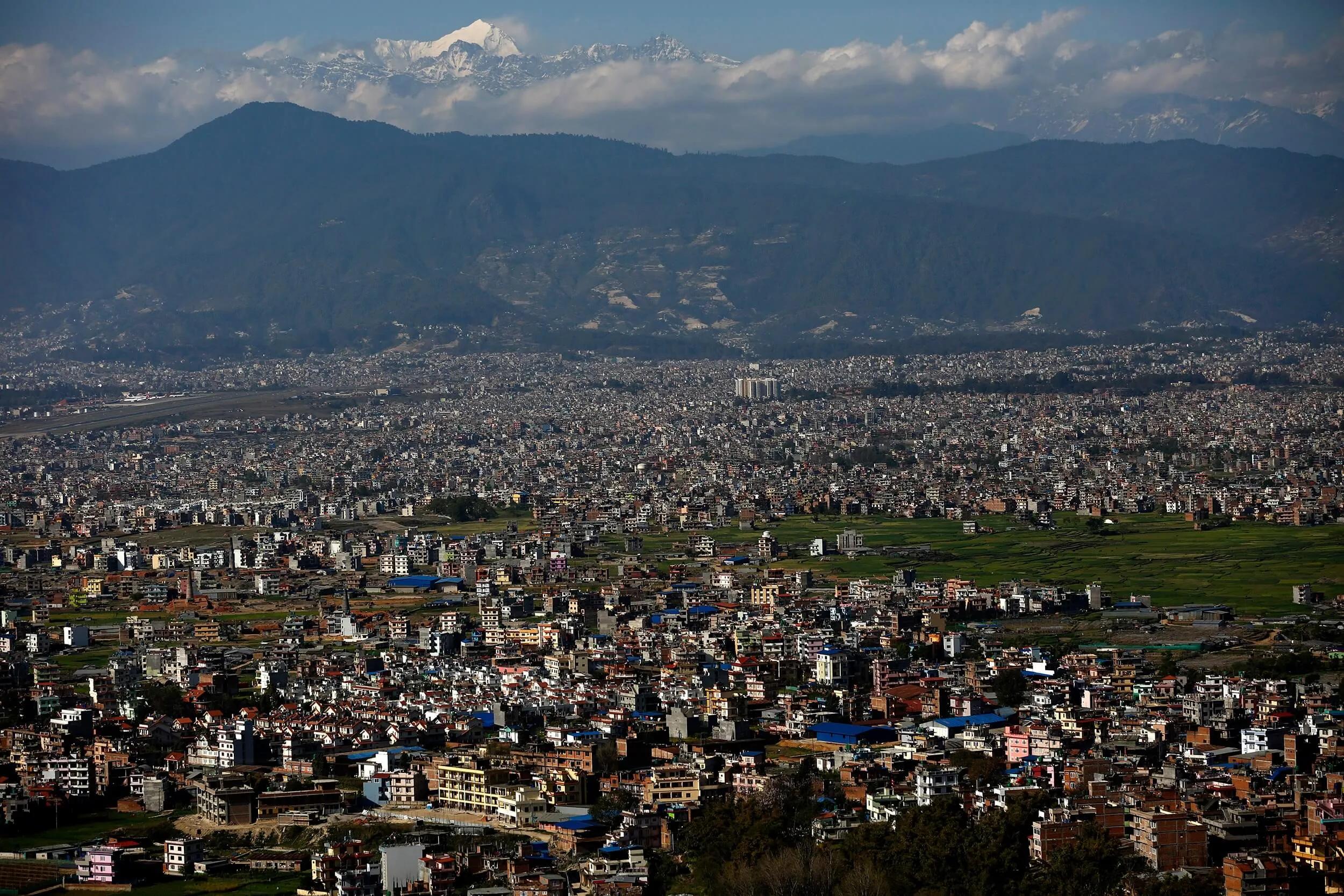
Upon your arrival at Tribhuvan International Airport, Kathmandu, a dedicated representative from Alpine Club of Himalaya will warmly welcome you and assist with your transfer to the hotel. Kathmandu, the capital city of Nepal, is a vibrant hub of history, culture, and spiritual heritage, blending modern urban life with centuries-old traditions.
After settling in, take some time to rest and recover from your international flight. In the evening, enjoy a special welcome dinner featuring authentic Nepalese cuisine, where you can try traditional dishes such as dal bhat, momo, and Newari specialties. This evening also provides an opportunity to meet fellow trekkers, discuss the upcoming adventure, and participate in a brief orientation session led by your Alpine Club of Himalaya guide, where essential information about the trek, safety measures, and logistics will be shared.
Max. Elevation
1400
Accommodation
Hotel
Meals
Welcome Dinner
Airport pickups and drop-offs by private vehicle for your convenience
Two nights’ accommodation in Kathmandu on a twin-sharing basis, including breakfast (3-star standard)
Best available teahouse accommodations throughout the Everest trek, offering comfort and local hospitality
All meals during the trek: breakfast, lunch, and dinner prepared freshly at teahouses
Welcome and farewell dinners in Kathmandu to celebrate the start and end of your adventure
All ground transportation by comfortable private vehicles as outlined in the itinerary
Domestic flights between Kathmandu and Lukla aboard regular Twin Otter planes, ensuring safe and scenic travel
Entrance fees for sightseeing and monument visits included in the itinerary
An experienced, English-speaking, and government-licensed trek leader plus an assistant guide for every 10 trekkers to provide expert support
Porter service with one porter provided for every two trekkers to carry your main luggage, allowing you to trek with a light daypack (every 2 trekkers-1 porter)
Full staff costs including salaries, insurance, equipment, domestic airfare, food, and accommodation for guides and porters
Use of down jackets and sleeping bags during the trek (to be returned after trip completion) for your comfort and warmth
A complimentary Alpine Club of Himalaya t-shirt and trekking map as souvenirs
All necessary permits and paperwork, including National Park Permit and TIMS (Trekkers’ Information Management System)
A comprehensive medical kit carried by your trek leader for safety and first aid support
All applicable government and local taxes for a transparent pricing structure

Click on map to view in fullscreen
Essential Trekking Gear and Packing List
For a challenging high-altitude trek like the Everest Three Passes Trek, proper gear is crucial to ensure safety, comfort, and enjoyment. Alpine Club of Himalaya recommends the following list of essentials, organized by category, so trekkers can prepare thoroughly.
Clothing
Due to varying altitudes (1,300m to over 5,500m), layering is key for temperature regulation.
Base Layer (Moisture-Wicking)
Insulating Layer
Outer Layer (Water & Windproof)
Trekking Pants
Shirts
Underwear and Sleepwear
Head and Handwear
Footwear
Bags
Sleeping Gear
Personal Items and Toiletries
Toiletries
Health and Safety
1. Altitude medication (Diamox if prescribed)
2. Painkillers (Ibuprofen, Paracetamol)
3. Antibiotics (if prescribed)
4. Rehydration salts
5. Antiseptic cream
6. Band-aids and blister pads
Trekking Essentials
Optional but Helpful Items
What Not to Pack
Note:
F
Francesca Lombardi
Milan, Italy
May 31, 2025
S
Sofia Gonzalez
Madrid, Spain
May 5, 2025

W
Wilhelmina Kastrup
Copenhagen, Denmark
Apr 25, 2025
A
Anna Müller
Berlin, Germany
Apr 11, 2025

24/7 Support
Need help? we're at your service
Associated With


We Accept Cards

Office of the company registrar License: 66813/066/067 || Tourism Industry Division License:1142
All content and photography within our website is copyright & may not be reproduced without our permission.
Develop By: IT Sansaar